Located 867 kilometres from Bangkok, Phuket Province is the largest island in Thailand, with a total area of approximately 576 square kilometres.
Within Phuket, the provincial administration is divided into 3 districts; Mueang Phuket district, Kathu district, and Thalang district. These are split into 13 sub-districts and a total 96 villages.
Local government administration consists of 1 provincial administrative organisations, 12 municipalities, and 6 sub-district administrative organisations.
Further information is available on the link below:
Land Use Policy and Law Phuket Province
The land-use policy and law differs depending on the colour of the city plan, how many floors can be built, or whether the surrounding land can be bought or not.
For example,
Environment Announcement (B.E. 2560) – Maximum Construction Rules
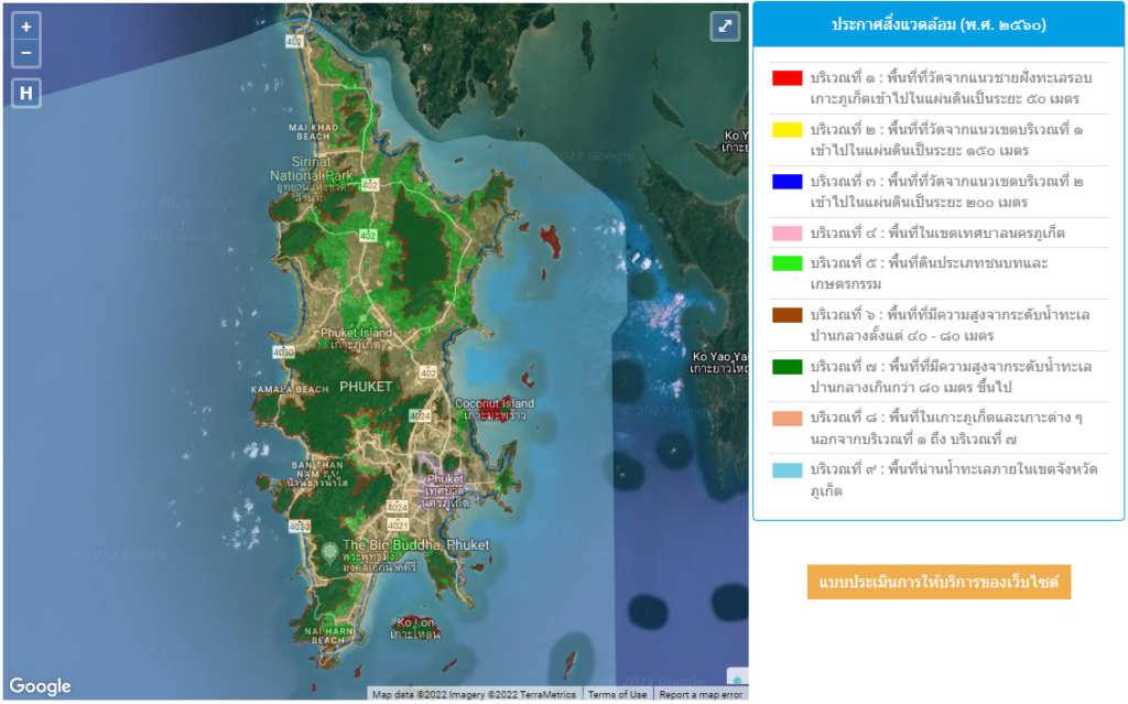
Red Area 1: When measuring the area from the coastline inland, the first 20 metres cannot be built on. From 21-50 metres, buildings can be 6 metres high.
Yellow Area 2: The area measured from the boundary line of Area 1, enters inland for a distance of 150 metres, and can be built up to 12 metres high.
Blue Area 3: The area measured from the boundary line 2 goes inland for a distance of 200 metres, and can be built up to 16 metres high.
Pink Area 4: Areas within Phuket Municipality can be built up to 45 metres high.
Green Area 5: Rural and agricultural land can be built 6 metres high, with the potential to add an extra 6 metres (by special request).
Brown Area 6: An area with an elevation of 40 – 80 metres above sea level and a height of 8 metres.
Dark Green Area 7: Within areas with an elevation of more than 80 metres above sea level, construction is not permitted.
Orange Area 8: Areas in Phuket Island and other islands other than Areas 1 to 7, can be built up to 23 metres high.
Blue Area 9: Construction is forbidden within the territorial water areas of Phuket Province.
Town Planning Law No. 4 (B.E. 2558)
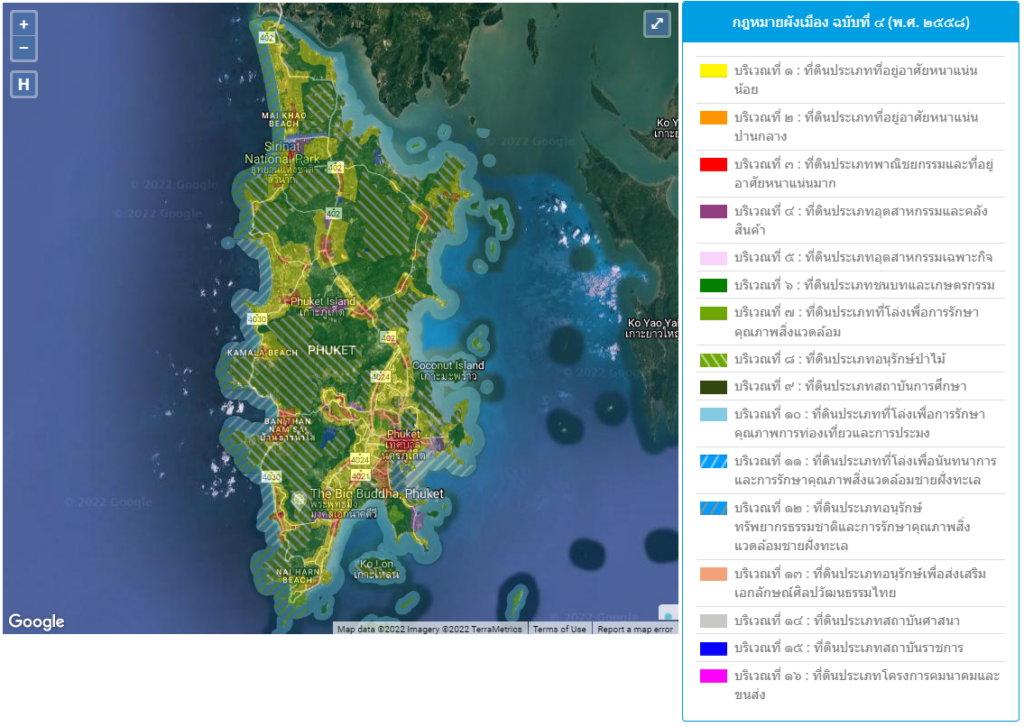
Yellow Area 1: Low-density residential land.
Orange Area 2: Medium-density residential land.
Red Area 3: Very dense commercial and residential land.
Purple Area 4: Industrial land and warehouses.
Pink Area 5: Specialised industrial land
Dark Green Area 6: Rural and agricultural land
Light Green Area 7: Land that is open for environmental conservation.
Green Dotted Area 8: Forest conservation land.
Green Dung Area 9: Educational institute-type land.
Blue Area 10: Open land for the preservation of tourism and fisheries.
Blue Dappled White Area 11: Open land for recreation and the preservation of coastal environment quality.
Blue, Brown Dotted Area 12: Land in the category of natural resource conservation and coastal environment preservation.
Orange Area 13: Conservation-type land to promote Thai cultural identity.
Gray Area 14: Land of religious institutions.
Blue Area 15: Land in the category of government institutions.
Pink Area 16: Land in the category of transportation and transportation projects.
Area Slope (percentage)
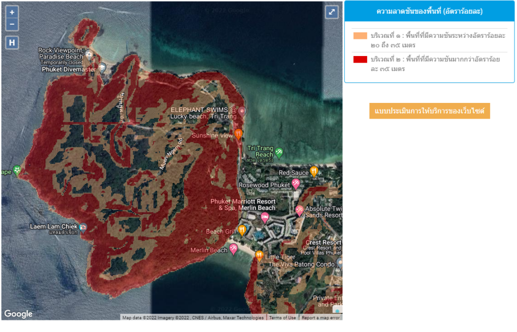
Orange Area 1: An area with a slope between 20 and 35 %.
Red Area 2: An area with a slope greater than 35 %.
